Hurricane Erin strengthens to Category 2 with 100 MPH Winds; Category 4 possible by Sunday
The Met Department warned that if the current intensity continues, Hurricane Erin could strengthen into a Category 4 storm by Sunday.
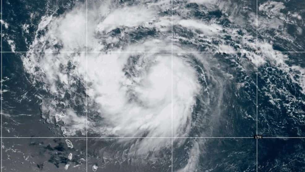
Hurricane Erin has now advanced to a Category 2 hurricane with winds of 100 mph and a pressure of 979 mb. Erin has been rapidly intensifying throughout the weekend throughout the overnight hours and is set to soon be a Category 3.
According to Met Department, if it continues in the same intensity pattern Hurricane Erin is expected to advance to a Category 4 hurricane by Sunday.
Fortunately Erin will not impact any land directly even at its peak intensity.
In light of Hurricane Erin advancing to a Category 2 Hurricane, the Caribbean Airlines has announced a cancellation of a few of its flights including flights to Tortola and the BVI on Saturday Aug 16th.
The airlines have advised customers to check their flight updates 3 hours before heading to the airport for as Hurricane Erin continues to intensify, more flights within and out of the Caribbean are due to be cancelled.
Hurricane Erin was declared a Category 1 Hurricane on late Friday and as of early Saturday morning the Hurricane already intensified into a Category 2 hurricane.
It is yet to be known the effects that it has had on the Caribbean but during its Category 1 status. A Tropical Storm Watch is in effect for Barbuda while a Tropical Cyclone Alert was in effect for the mainland of Antigua.
Erin is also expected to influence the weather in Trinidad and Tobago with high winds and heavy rainfall throughout the weekend however experts say that it poses no direct threat to Trinidad and Tobago but still citizens are advised to stay on high alert.
St Martin, Anguilla, St Barts and Barbuda are reported to experience breezy as well as rainy conditions possible in its areas over the period of the next hours.
As the National Hurricane Center has forecasted that Hurricane Erin is set to rapidly intensify throughout the weekend and by Sunday, August 17 it is predicted to have intensified into a Category 4.
According to sources the storm is said to be traveling west-northwestward across the Atlantic, where it will have some impacts as it brushes the northeast Caribbean.
Author Profile

Monika Walker is a senior journalist specializing in regional and international politics, offering in-depth analysis on governance, diplomacy, and key global developments. With a degree in International Journalism, she is dedicated to amplifying underrepresented voices through factual reporting. She also covers world news across every genre, providing readers with balanced and timely insights that connect the Caribbean to global conversations.
Latest
- Saint Lucia: Soufrière ranked World’s second happiest travel...
-
Trinidad’s Bascombe captures her first silver medal in Commo... -
Saint Lucian Kisha Kay crowned first-ever female Groovy Soca... -
Grenada: Lindon Victor makes Commonwealth Games history with... -
“There will be nothing like this in Western Hemisphere,” PM...


