
Bahamas under severe weather advisory as thunderstorms, heavy rain and flooding risk persist
The Bahamas remains under unsettled weather conditions, with thunderstorms, heavy rainfall, strong wind gusts and a risk of flooding expected across parts of the country.
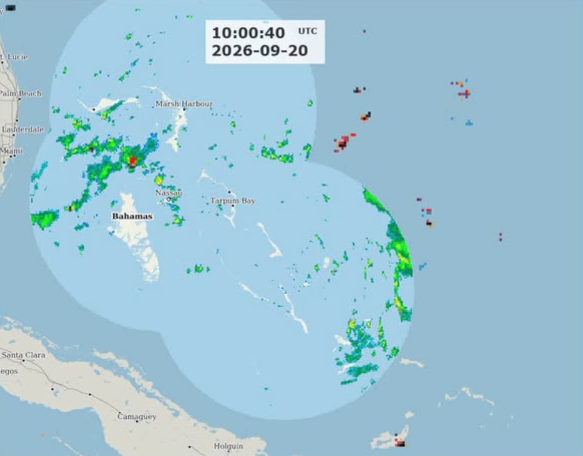
Bahamas: The Bahamas is facing an unstable weather situation, based on the warning issued by Bahamas Department of Meteorology regarding thunderstorms, intense rainfall, strong wind gusts and an increased flooding risk throughout several areas of the country. The department’s 6:00 a.m. weather projection released on Sunday, September 20, stated that a Severe Weather Advisory remained active for the Central and Southeast Bahamas, along with the Turks and Caicos Islands.
Meteorologists stated that an upper-level-low-pressure system close to Central Florida is carrying a large amount of tropical moisture throughout the Bahamas, as a surface trough over the central and Southeast Bahamas is projected to trigger heavy periods of rains and thunderstorm activity. Together these factors are bringing cloudy skies and unsettled weather conditions.
The meteorological department has determined a medium risk of isolated intense to very intense thunderstorms throughout the parts of Northern and Northwest Bahamas. Severe thunderstorms could trigger strong wind gusts, consistent lightning, intense rainfall and potential waterspout conditions. In addition there is a light-to-moderate threat of flooding in low-altitude and flood-vulnerable areas, specifically under conditions of intense or long-lasting rainfall.
Across the Central and Southeast Bahamas, comprising Exuma, Cat Island, Long Island, Inagua, Crooked Island, San Salvador, Acklins, Ragged Island and Mayaguana, the weather outlook predicted a 40-50 % probability of scattered rainfall and isolated thunderstorms. Several thunderstorms could evolve into strong to powerful, along with the possibility of significant rainfall.
The weather situation is predicted to persist unstable through Monday and Tuesday. The Northern and Northwest Bahamas is projected to experience a 40-50 % probability of showers and thunderstorms scattering throughout the region, whereas the Central and Southeast region has a 20-30% chance on Monday, September 21.
The seven-day weather forecast revealed that shower and thunderstorm conditions would persist until at least Saturday, September 26, however the chances of rainfall would differ on the basis of area. The Central and Southeast region are expected to remain rainier than the Northern and Northwest Bahamas by the end of the week.
The Bahamas weather outlook also informed that Tropical Storm Fay had developed in the region of the Atlantic. However, according to the recent weather update by the U.S. National Hurricane Centre released on Monday, detected Fay approximately 620 kilometres southwest of the Azores with peak sustained winds of 70 mph (110 km/hr) and reported that there were no coastal alerts effective as of now and no land-based hazards related to the storm.
Author Profile
Stay updated with WIC News' coverage of all the major happenings and updates on the developing weather systems across Caribbean including Hurricanes, Tropical Storms or Cyclones.
Latest
- Dominica’s Olympic champion Thea LaFond-Gadson receives hono...
-
Belize: Social media creator Benjamin Garcia detained after... -
Trinidad: Handcuffed prisoner reportedly escapes from Eric W... -
Jamaica: PM Andrew Holness orders urgent action after three... -
PM Drew celebrates Taiwan’s National Day, highlights 43 year...