Hurricane Gabrielle rapidly strengthens into Category 4 storm East of Bermuda
Gabrielle rapidly intensified from a Category 1 to Category 4 hurricane within 24 hours and is expected to remain over the open ocean.
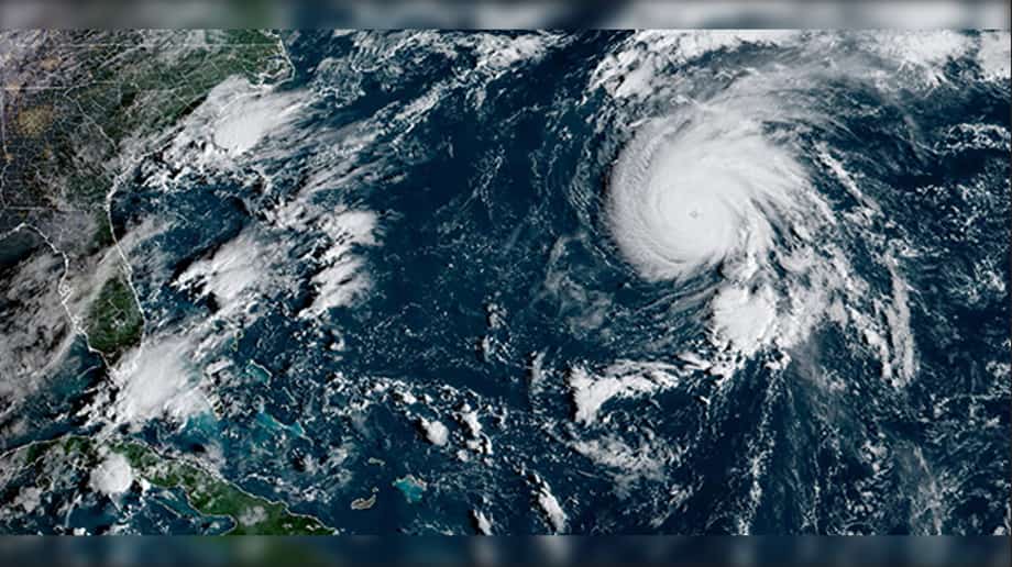
Miami: Hurricane Gabrielle has rapidly intensified into a Category 4 Hurricane as of September 23, 2025 having winds of 140 mph and a 948 millibar pressure, positioned 200 miles east of Bermuda and moving northward-northeast at 12 mph.
Gabrielle has rapidly strengthened over the past 24 hours, going from category 1 to category 4 Hurricane, and is said to fortunately remain over the open ocean.
The National Hurricane Centre has warned of Gabrielle Passing East of Bermuda. While insisting that interests in the Azores should monitor its progress.
No reports of the rapid intensifying Gabrielle to have touched any Caribbean land but with the rapid intensification weather advisories have been issued.
Well that escalated quickly. Back from a weekend trip and all the basins have plenty of action. Once again we get lucky with another high end miss in #Gabrielle
— Jim Cantore (@JimCantore) September 23, 2025
That said, 2 systems behind that bear watching with a trough lifting out and ridge building over the Great Lakes… pic.twitter.com/VCydUV7xla
Gabrielle became a Category 1 hurricane on Sunday, and quickly intensified to a Category 3 hurricane by Monday as it resided in the warm Atlantic waters. The storm’s path was taking it east of Bermuda.
With this year’s Atlantic hurricane season being relatively quiet experts say there’s a few reasons for that, but it doesn’t mean dangerous hurricanes are due to not form later.
A hurricane heading east-northeast away from Bermuda rarely looks this impressive on satellite imagery.
— James Peacock (@peacockreports) September 23, 2025
Gabrielle currently has peaked sustained winds of 140 mph. Forecast to start weakening this afternoon, & pass near or over the northern Azores as a cat 1-2 hurricane Thu-Fri. pic.twitter.com/gcWtHaQRts
The Atlantic hurricane season is set to end on November 30, with the previous experienced hurricane being Erin from August 11 to 28, and now Gabrielle from September 21 .
Whilst in the Pacific, Tropical Storm Narda has reportedly emerged offshore of Mexico on Sunday.
According to experts as of Tuesday September 23, Tropical Storm Narda is off the coast of Mexico in the Eastern Pacific and is said to be gradually strengthening and should become a hurricane sometime later today.
With no major impacts expected as it predicted to remain in the open waters to the west.
Author Profile
Stay updated with WIC News' coverage of all the major happenings and updates on the developing weather systems across Caribbean including Hurricanes, Tropical Storms or Cyclones.
Latest
- Jamaican Minister Desmond McKenzie pepper-sprayed by police...
-
St. Kitts and Nevis Restaurant Week 2026 kicks off July 16 w... -
Julien Alfred clocks season's best 10.87 to win Budapest 100... -
US and CARICOM sign Biometric Data-Sharing Agreement to stre... -
Guyana to launch full online curriculum through digital scho...


")
