
Tropical Storm Dolly weakens into tropical wave, flash flood threat looms over Leeward Islands
Tropical Storm Dolly has weakened and lost its tropical-storm features and degraded, evolving into an open tropical wave but its remnants could cause flash floods, gale-force winds along with extremely rough seas to the Leeward Islands this weekend.
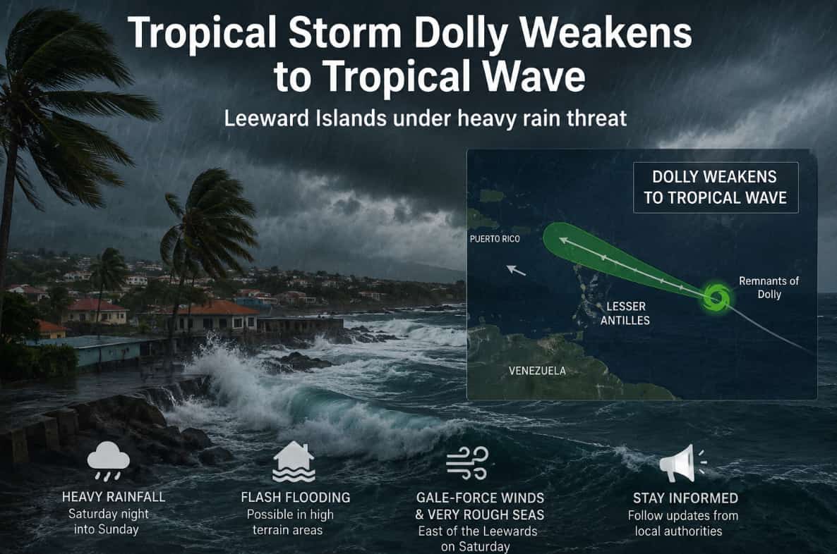
Caribbean: Residents based in the Leeward Islands are being urged to continue monitoring the remnant of the Tropical Storm Dolly by the U.S. National Hurricane Center (NHC), as the weather system moves swiftly westward in the direction of the eastern Caribbean.
Although, the weather conditions have been transformed since the preliminary alerts. According to the NHC stated on Friday, Dolly has weakened and lost its tropical-storm features and degraded, evolving into an open tropical wave.
Dolly originated across the central tropical Atlantic on Thursday, August 27, emerging into the fourth named storm of the 2026 Atlantic hurricane period. Dolly was located about 1,555 miles east of the Leeward Islands. During its extreme cycle, the weather system had the highest persistent winds at around 40 miles per hour and was approaching west at roughly 24 miles per hour.
Tropical Storm Dolly has maximum speeds of 40 mph.
— Southern FFA Family (@FFAFamily) August 27, 2026
If Tropical Storm Dolly stays on its current path, it’s expected to reach the Leeward Islands early Sunday morning.
Tropical Storm Dolly is expected to weaken into a tropical wave before reaching the islands. pic.twitter.com/iXvippjwRL
The storm was initially projected to move into the Leeward Islands over the weekend, which subsequently prompted the officials and residents to monitor the movement of the storm. However, escalating vertical windflow and drier air disturbed Dolly’s movement which led to rapid weakening of the storm.
Now, the NHC identifies the weather system as a significant tropical wave instead of a tropical storm. Though, the storm’s remnants are currently projected to move toward waters of the east of the Leeward Islands on Saturday, at where Dolly could cause gale-force winds along with extremely rough seas.
As the changing conditions are identified, the main threat is now heavy rainfall rather than the persistent tropical storm winds. The NHC stated, rainfall related to the Dolly’s remnants may begin impacting the Leewards Islands from Saturday night into Sunday.
The weather system could possibly impact the Virgin Islands and Puerto Rico, alongside circumstances potentially spanning to Hispaniola by Sunday and Monday. Weather specialists warned that the cycles of heavy rainfall could prompt flash flooding, specifically in hilly and higher-altitude areas.
NHC, also stated that Dolly is not projected to retain its tropical-storm state while it nears the islands. However, rough seas and strong gusty winds amid thunderstorms could also occur.
Author Profile
Stay updated with WIC News' coverage of all the major happenings and updates on the developing weather systems across Caribbean including Hurricanes, Tropical Storms or Cyclones.
Latest
- Bahamas issues severe weather warning to New Providence
-
Caribbean Airlines adds flights as Tobago gears up for Carni... -
Colombian Pastor dies after alleged gang beating in Cartagen... -
Trinidad and Tobago: 19-year-old found dead from gunshot wou... -
Dominica: Samantha Bazil of Wesley wins Crowned Miss Wob Dwi...